- Get link
- X
- Other Apps

Pangarchulla Peak. Ever since I found out that this was a trekkable peak, I had made up my mind that I had to stand atop it. At 53, it’s too late to go through mountaineering courses to be eligible for climbing but then peaks like Pangarchullar are the next best thing. I had already trekked to the Valley of flowers, Tungnath- Chandrashila, and Kedarkantha in a span of 6 months from July to December 2018. Several constraints did not permit a trip throughout 2019 until I finally decided; it had to be Pangarchulla and thankfully the dream was realized when my friend Ajay Rawat of Lammergeier Himalayan Experience in Joshimath informed me I could be part of a group scheduled for November.

As every trekking enthusiast understands that the thrill of
negotiating a mountain ridge with a biting cold wind threatening to blow you
off is the best feeling in the world. It may be tough but to once again walk on
snow or to stand on a scenic viewpoint and watch the sunset on peaks just like
this photograph of the sun setting on Dronagiri is an immaculate experience. I
was finally going to be in the mountains again.
Pangarchulla trek, a
brief description
The Pangarchulla peak derives its name from the Pangar fruit that grows in the region. From the summit, the valley looks like a chullar,
(clay oven) hence the name Pangarchulla

Pangarchulla peak is a significant trekking destination as
it is an introductory peak to the world of mountain climbing. Moreover, the
variety of terrain throughout the route is exceptional and in winter especially,
the endless fields of snow, narrow ridges and steep inclines can be challenging.
It can really test your endurance where the snow is deep. Deciding on the trek
to Pangarchulla depends on whether you want to experience the beauty of greenery
or a non-technical climb cum snow trek in which case, winter, post 15th
November is the best time.

The route to Pangarchulla is dominated by the mighty
Dronagiri and once you get to the first camp, be prepared for some spectacular
views of the peak. En route to the last part of the climb will reward you with
a panorama of peaks like Mana, Mandir, Hathi -Ghoda, Barmal, Lampak Massif,
Dronagiri, Rataban, and Bethar-toli humbling you in their presence.

The Pangarchulla trek is classified as a difficult trek with
the summit journey and back to base camp taking over a grueling 12 hours. It is
not advisable for beginners without an adequate level of fitness wanting to
experience a frolic in the snow. This is a seriously underestimated trek so if
you haven’t done a trek before that, you may want to rethink a more moderate
destination. That being said, for those who are fit and for trekking
enthusiasts wanting to hike up their game, Pangarchulla is perfect.
29. 11. 2019 New
Delhi -Haridwar
 |
| Haridwar |
I reached Haridwar on 29th November and after an
overnight stay left for Joshimath the next morning. Accompanying me was my son
Francis and if you are just two or three people, be sure to get a sumo for
Joshimath not later than 8 am. It costs
around 600 per person form Hardwar to Joshimath with a journey time of
approximately 9 hours. It would be
advisable to take the Lammergeier package that includes transport from Dehradun.
30.11.2019-Joshimath
 |
| Joshimath |
Joshimath was cold. If you are in Joshimath in winter, make
sure you have dinner early as most eateries close sooner in winter and food can
also, get pretty expensive when options are low. It was a nice feeling being
back in Joshimath after a year, unfortunately, we missed the snowfall that
occurred a week after we left.


Day 1-31.11.19: Joshimath-(30mins drive)-Dhak
village-(trek–4km)-Guiling -4hrs
Altitude 6,900 ft.
(2,103 m) to 9,396 ft. (2,864 m);
The next morning was the first official day of the trek. I
finally got to meet members of my group, Dipika and Sachin of Bikat Adventures,
Akash Gaba, Bharat Daga, Sanjay Nair, Shreekanth Khandelwal, and Abhijeet. Our
guide was the indomitable and very friendly Debu from Lammergeir Himalayan
Experience. After a briefing by Sachin and Deepika, we set off to the first camp Guiling (2305 meters).


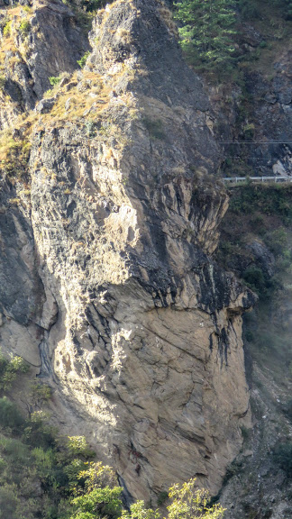
The trek from Kharchi or Dhak is a steep incline along a
dirt trail that leads to Tugasi Village. It is a well-defined trail and the
weather in November was beautiful. Dronagiri looks over you throughout the
journey growing larger as you approach Tugasi along the way.


 |
| mess tent |
 |
| Mt Dronagiri from Guiling camp |
 |
| With Francis at Guiling Campsite, Mt Dronagiri in the background |
 |
| Sunset on Dronagiri, Guiling camp 9396 ft |
 |
| Sunset on Mt Dronagiri-7066 mts |
Altitude: 9,396 ft (2,864 m) to 11,125 ft
(3,391 m);
Day 2 of the trek you will be trudging in snow across terrain dominated by oak forests along
the way. While there is ample sunshine in the day time, the shade of the forest can
make it cold too, so always make sure you wear the proper clothing with a sun
cap, ear protection, and gloves. From day 2 you will also be made to wear
gaiters and crampons.
 The forest
landscape is not as steep as the first day and was an enjoyable trek to
Khullara camp. Fill your bottles at Guiling before leaving because although
there are a few streams along the way, there is no assurity of water. Moreover,
I personally believe that drinking water from sloping streams or falls that
have water flowing over smooth rock surfaces and deep streams is safer than
water from horizontal shallow streams.
The forest
landscape is not as steep as the first day and was an enjoyable trek to
Khullara camp. Fill your bottles at Guiling before leaving because although
there are a few streams along the way, there is no assurity of water. Moreover,
I personally believe that drinking water from sloping streams or falls that
have water flowing over smooth rock surfaces and deep streams is safer than
water from horizontal shallow streams.
 Throughout
the trek, the mountains will be playing hide and seek where Dronagiri as usual
looks over you and you will also be seeing the Hathi Ghori peaks too.
Throughout
the trek, the mountains will be playing hide and seek where Dronagiri as usual
looks over you and you will also be seeing the Hathi Ghori peaks too.


The Khullara campsite was on a
clearing completely buried in deep snow. Trampling and flattening the area was
a good warming workout too as we were shown how to construct a tent by Debu and
Sachin. The Khullara campsite was completely covered with thick snow.

 What makes the campsite endearing is the fact that a short 30-minute walk above the camp will give take
you to an area full of small boulders and the intricate patterns of the snow-covered
landscape is magical. From here too you
will be gifted with panoramic views of the peaks like Mt Kamet and Rataban the
sentinel that overlooks the valley of flowers finally comes into view
What makes the campsite endearing is the fact that a short 30-minute walk above the camp will give take
you to an area full of small boulders and the intricate patterns of the snow-covered
landscape is magical. From here too you
will be gifted with panoramic views of the peaks like Mt Kamet and Rataban the
sentinel that overlooks the valley of flowers finally comes into view
This is the beauty of the Pangarchulla trek where regardless of the summit, the views of mountains and the surrounding landscape is breathtaking.


This is the beauty of the Pangarchulla trek where regardless of the summit, the views of mountains and the surrounding landscape is breathtaking.


Day 3: Summit day: Lower Khullara to Pangarchulla-12 km Time: 12 -14 hours
Altitude: 11,125 ft (3,391 m) to 15,069 ft
(4,593 m) to 11,125 ft (3,391 m); 12 km
The day of
reckoning, the longest day of the trek that will challenge you every step of
the way. The summit day is when you are met with the true challenge of the
Pangarchulla trek which makes you realize why it is considered a difficult
trek. Trekking in deep snow makes it even tougher where the last leg of the
trek leaves you exhausted and every step becomes an effort especially when it
involves navigating the steep inclines.


 |
| Pangarchulla in the distance |


 |
| Kamet 7768m |

Day 4: Khullara to Joshimath via Dhak
 The next day was a brisk lovely walk back to Dhak via the
same Tugasi village where we stopped for tea and snacks. It was here that I met
this beautiful little furball. The best part of any trek is meeting these mountain
dogs who are extremely friendly and adorable.
The next day was a brisk lovely walk back to Dhak via the
same Tugasi village where we stopped for tea and snacks. It was here that I met
this beautiful little furball. The best part of any trek is meeting these mountain
dogs who are extremely friendly and adorable.


 |
| Stunning Moon at daytime over Nanda Devi 7816 m |
 |
| Hanuman Rock between Dhak and Joshimath |
The Group
 |
| Add caption |
Standing L-R: Sanjay, Akash, Bharat, Shreekanth, Amit, helpers, and cooks
Kneeling L-R: Andrew, Debu, Dipika, Sachin, Francis
Short itinerary for
those interested: The Pangarchulla trek takes nothing less than 7 days from Delhi
Day 1. Delhi to Haridwar/Dehradun (take the 6am or 3.20 m
train), overnight in Haridwar: 4hrs
Day 2. Haridwar/Dehradun to Joshimath by Tata sumo/bus
(Haridwar railway station bus/taxi stand): 9/10 hours
Day 3. Joshimath-Dhak (drive)-Guiling Camp Trek (3-4 hrs)
Day 4. Guiling-Lower Khullara (3-4 hrs)
Day 5. Lower Khullara-Pangarchulla summit-Lower Khullara (12-14 hrs)
Day 6. Khullara-Dhak-Joshimath
Day 7: Joshimath-Dehradun/Haridwar-(night train) - Delhi)
BESIDES REGULAR GEAR
DON’T FORGET TO CARRY (compulsory in
winter)
- Warm gloves, snow jacket, light jacket,
- Thermal wear, woolen socks 2 pairs
- Snowproof shoes, fleece
- 2 bottles, wet wipes toilet paper (you can’t imagine how important this is)
- small backpack for summit day
- head torch
- Trekking pole.
If you are keen on going on the Pangarchulla Trek then I
suggest you get in touch with Lammergeier Himalayan Experience who provide really go services for this trek. The people are very friendly and will ensure you have
an amazing time without burning a hole in your pocket. The address and contact
numbers are given below.
Lammergeier Himlayan Experience
Near HotelNanda Devi, Joshimath
Ph: +918006404570 (contact Ajay Rawat)
Lammergeier Himlayan Experience
Near HotelNanda Devi, Joshimath
Ph: +918006404570 (contact Ajay Rawat)
Please like my Facebook page at